
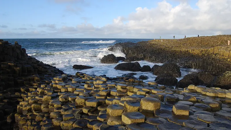
 Giant's CausewayHexagonal basalt columns step down into the sea below the cliffs north of Bushmills, formed as lava cooled just under 60 million years ago. It became a World Heritage Site in 1986.
Dog-friendly days out in Ireland
198 places on our county lists that take a dog by their nature: beaches, walks and greenways, forests, parks, the national parks, mountains, cliffs, lakes and waterfalls, each with a page of its own, and 218 more from Fáilte Ireland’s listings. On a lead unless the sign says otherwise; the summer beach bylaws are below.
Giant's CausewayHexagonal basalt columns step down into the sea below the cliffs north of Bushmills, formed as lava cooled just under 60 million years ago. It became a World Heritage Site in 1986.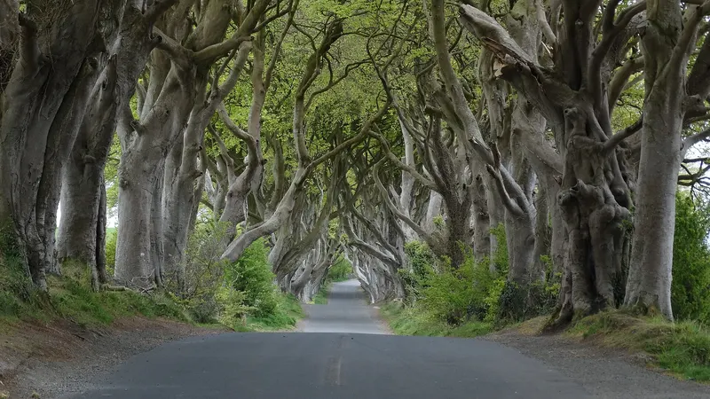 The Dark HedgesJames Stuart planted this avenue of beech trees on Bregagh Road in 1775 as the approach to Gracehill House, and the branches have grown together over the road. The road is closed to cars, so park at the Hedges Hotel and walk the few minutes up.
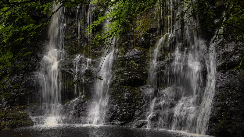 Glenariff Forest ParkA boardwalk first built about a hundred years ago runs down the river gorge past the waterfalls, and the viewpoint trail looks down the glen to the sea.
Leinster
Carlow4 places
 South Leinster WayWalk · Borris104km of waymarked route from Kildavin through Borris, over the Barrow into Kilkenny and on to Carrick-on-Suir in Tipperary.
- Clogrennane WoodForest · Carlow townMixed woodland on the Barrow south of Carlow town, with a signed loop through the beech and oak.
2 more from Fáilte Ireland’s listings
- Bahana ForestForest park · Co. CarlowBahana Forest is an old woodland parkland that slopes down to the banks of the Barrow River in County Carlow.
- Oak Park Forest ParkForest park · CarlowThe park is a mature, mixed-species woodland of about 50 hectares, with a predominance of beech, oak, Scots pine, silver fir, larch and sycamore.
Dublin29 places
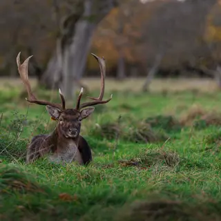 The Phoenix ParkPark · Dublin 8The walled park on the edge of the city has a wild deer herd in it and long straight roads through it.
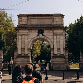 St Stephen's GreenPark · Dublin 2A square of park in the middle of the south side, with a lake, a bandstand and gates onto Grafton Street.
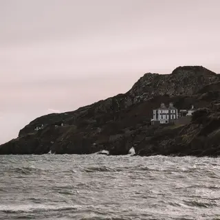 The Howth cliff walkWalk · HowthThe loop goes around the head from the village, cliffs on one side and Ireland's Eye offshore.
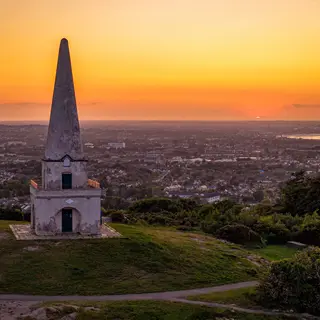 Killiney HillViewpoint · KillineyShort climb above the coast to an obelisk, with the whole of Dublin Bay below it.
25 more from Fáilte Ireland’s listings
- Blackrock ParkPark · BlackrockFacilities include free parking and public toilets.
- Tolka Valley ParkPark · BlanchardstownTolka Valley Park is spread over 140 hectares, near Blanchardstown in Dublin City.
- Donabate, Balcarrick BeachBeach · DonabateDonabate Beach which is also known as Balcarrick Beach is located in Donabate, North County Dublin.
- Griffith ParkPark · DublinSituated in Dublin City on the Tolka River between Glasnevin and Drumcondra and just downstream from the National Botanic Gardens, Griffith Park extends to 7.5 hectares.
- Phoenix Park - People’s Flower GardensPark · DublinPhoenix Park - People’s Flower Gardens in Dublin's Phoenix Park are 22 acres in size.
- Blessington Street Basin (Dublin's Secret Garden)Park · Dublin City
- Killiney BeachBeach · KillineyKilliney is a sheltered, stony beach located in County Dublin, suitable for bathing and swimming.
- Fairview ParkPark · FairviewFairview Park is situated in the heart of Fairview near Clontarf, just North of Dublin City.
- Portrane BeachBeach · PortranePortrane Beach is a 2km stretch of sandy beach located in the seaside village of Portrane, County Dublin.
- Marlay DemesnePark · RathfarnhamLocated about 9km from Dublin City centre, Marlay Demesne or Park is found in Rathfarnham, at the foothills of the Dublin Mountains, but easily accessible by bus 16.
- Marlay ParkPark · RathfarnhamLocated about 9km from Dublin City centre, Marlay Demesne or Park is found in Rathfarnham, at the foothills of the Dublin Mountains, but easily accessible by bus 16.
- Rush, South BeachBeach · RushRush, South Beach is a popular beach located in the seaside town of Rush in County Dublin.
- Sandycove BeachBeach · SandycoveSandycove beach is a small beach close to the James Joyce Tower and Museum.
- Skerries South BeachBeach · SkerriesSkerries South Strand is a long sandy beach approximately 2.5km in length.
- Balbriggan BeachBeach · BalbrigganBalbriggan Beach is located in the traditional fishing village of Balbriggan, County Dublin.
- Sean Walsh Memorial ParkPark · TallaghtA vital local amenity for the Tallaght community since it opened in 1989, Sean Walsh Park is the St Stephen’s Green of Tallaght in Dublin City.
- Tymon ParkPark · TallaghtTymon Park in Tallaght, Dublin City, is a valuable resource for visitors and locals in the surrounding hinterland.
- Bushy ParkPark · TerenurePart of an extensive open space network along the Dodder River, in Dublin City, Bushy Park extends to 20.5 hectares.
- Barnageara BeachBeach · SkerriesBarnageera Beach can be found half way between Skerries and Balbriggan in County Dublin.
- Brickfield ParkPark · Co. DublinBrickfield Park in Drimnagh is a Dublin city park with an all-weather pitch, located between the Crumlin Road and Mourne Road.
- Bull IslandIsland or harbour · Co. DublinBull Island is a low lying island in the northern part of Dublin Bay, County Dublin.
- Eamonn Ceannt ParkPark · Co. DublinEamonn Ceannt Park is located between Sundrive Road and Clogher Road, in the Crumlin area of South Dublin City.
- Sandymount StrandBeach · Co. DublinSandymount Strand is a popular landmark in South Dublin and part of the Dublin Bay Biosphere Reserve.
- SeapointBeach · Co. DublinSeapoint Beach is located just outside Dún Laoghaire in County Dublin.
- Velvet Strand, PortmarnockBeach · PortmarnockVelvet Strand, Portmarnock is a wide strand of sandy beach located in Portmarnock, north County Dublin.
Kildare6 places
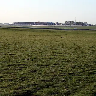 The CurraghPark · NewbridgeTwo thousand hectares of unfenced grass between Newbridge and Kildare town, grazed by sheep and worked every morning by racehorses.
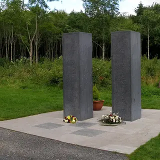 Donadea Forest ParkForest · ClaneNear Clane, forest laid out around the ruins of Donadea Castle, with a lake, a walled garden and a 9/11 memorial inside it.
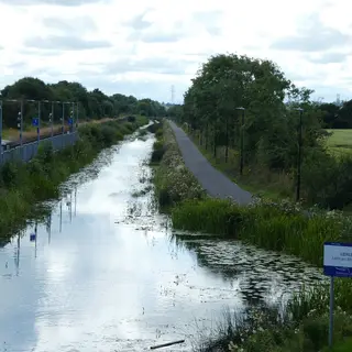 Royal Canal GreenwayGreenway · MaynoothFlat the whole way, running through Leixlip, Maynooth and Kilcock on its way west.
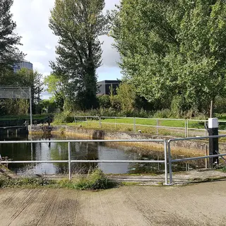 Barrow WayWalk · AthyThe towpath follows the Barrow south from Lowtown, through Athy and on into Carlow.
- Lullymore Heritage and Discovery ParkPark · RathanganOut on a mineral island in the Bog of Allen, with a peat heritage display, woodland trails and a boardwalk over the bog.
1 more from Fáilte Ireland’s listings
- Moore Abbey WoodChurch or abbey · MonasterevinMoore Abbey Wood is a mixed woodland of a variety of broadleaves and conifers, in Monasterevin County Kildare.
Kilkenny6 places
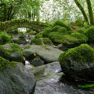 Kilfane Glen and WaterfallWaterfall · ThomastownThe wooded ravine near Thomastown was laid out in the 1790s, with a thatched cottage orné beside a made waterfall. It is closed for 2026 and opens again for July and August 2027.
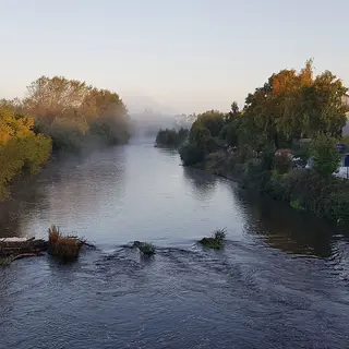 Nore Valley WalkWalk · InistiogeThe riverside path along the Nore between Inistioge and Thomastown, through woodland and past the Woodstock estate.
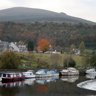 Brandon HillMountain · GraiguenamanaghThe highest hill in the county at 515m. It goes straight up behind Graiguenamanagh and a marked path takes you to the cairn on top.
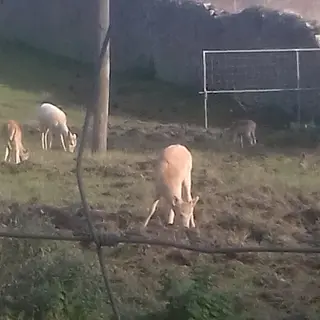 Castlecomer Discovery ParkPark · CastlecomerEighty acres of estate park in Castlecomer with two lakes, a coal mining exhibition and a treetop walk.
2 more from Fáilte Ireland’s listings
- Ballyrafton WoodPark · BallyfoyleBallyrafton Wood is a public wood about half way between Kilkenny and Castlecomer, in County Kilkenny.
- Coille an Fhaltaigh Millennium ForestPark · KilmanaghCoille an Fhaltaigh Millennium Forests is the largest of the 16 Millennium Forests that were planted in Ireland in the late 90's.
Laois5 places
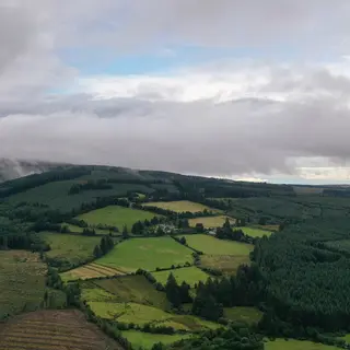 Slieve Bloom MountainsMountain · MountrathLow and flat-topped on the Offaly border, mostly blanket bog and forestry, with Arderin the high point at 527m.
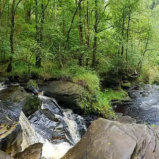 GlenbarrowWaterfall · ClonasleeGlenbarrow is where the River Barrow starts in the Slieve Blooms, with a waterfall in it and a looped trail from the car park.
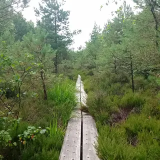 Abbeyleix BogBog · AbbeyleixThe boardwalk crosses a raised bog on the edge of the town. People from Abbeyleix blocked Bord na Móna's machines in 2000, and the town has looked after it since.
- Durrow Leafy LoopWalk · DurrowA long looped walk on lanes and woodland paths out of Durrow village, with shorter options signed off it.
- Ridge of CapardViewpoint · RosenallisThe ridge runs high across the Slieve Blooms, with a car park at the trailhead and long views out over the midlands. The boardwalk on the ridge is closed for repairs for now, so check the Slieve Bloom page before you go.
Longford5 places
- Royal Canal Greenway, LongfordGreenway · Longford townLongford carries the western end of the Royal Canal towpath, from Abbeyshrule towards the Shannon.
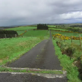 Corn HillMountain · DrumlishLongford's highest point is 278m, between Drumlish and Ballinalee, with a 3.2km marked trail up to two cairns on the summit.
- Newcastle WoodsForest · Ballymahon325 hectares of Coillte woodland on both banks of the Inny outside Ballymahon, with 28km of forest road and a 400m Access for All walk.
- Glen Lough Nature ReserveLake · EdgeworthstownThe reserve sits on the edge of Edgeworthstown, with paths around a series of ponds and a lot of birds on them.
- Derrycassin WoodForest · GranardCoillte woodland on the shore of Lough Gowna north of Granard, with signed walks and views over the lake.
Louth11 places
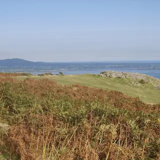 Slieve FoyeMountain · CarlingfordSlieve Foye rises directly above Carlingford, and a marked loop climbs off the edge of the village.
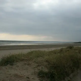 ClogherheadBeach · Co. LouthThe fishing village sits on a headland with a beach on either side of it and the pier at Port Oriel below.
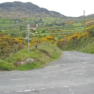 The Táin WayWalk · CarlingfordAbout 40km of waymarked circuit around the Cooley peninsula, starting and finishing in Carlingford.
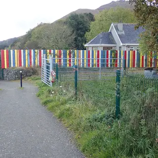 Carlingford GreenwayGreenway · CarlingfordFlat path on the old railway line, running along the shore of the lough between Carlingford and Omeath.
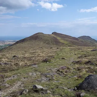 BarnavaveWalk · CarlingfordThe lower peak of the Carlingford range. The loop walk goes up from the village with the lough underneath you.
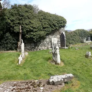 Hill of FaughartViewpoint · DundalkThe hill north of Dundalk carries an old graveyard, a holy well and a long view out over the plain.
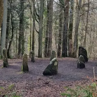 Ravensdale ForestForest · DundalkCoillte forest in the valley north of Dundalk, with waymarked trails and standing stones in among the trees.
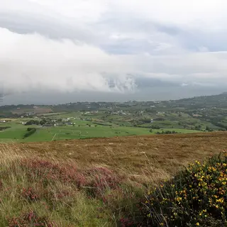 The Cooley PeninsulaViewpoint · CarlingfordCooley is the finger of land between Carlingford Lough and Dundalk Bay, mountain on one side and water on the other.
3 more from Fáilte Ireland’s listings
- Seapoint Beach, TermonfeckinBeach · NewtownSeapoint Beach is located less than 2 kilometres from the nearby village of Termonfeckin and 9 kilometres from Drogheda.
- Port, LurganboyBeach · Co. LouthPort, Lurganboy beach in County Louth, is a Blue Flag Beach situated 5kms north of the fishing village of Clogherhead.
- Templetown - Shelling Hill BeachBeach · Co. LouthTempletown - Shelling Hill Beach is called after the crusading Knights Templars.
Meath2 places
Offaly5 places
 Slieve Bloom MountainsMountain · KinnittyThe range sits low and forested on the Laois border, crossed by one long waymarked route with shorter loops signed off it.
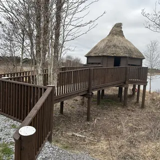 Lough Boora Discovery ParkPark · KilcormacA worked out bog was turned into a park, and it now has lakes, cycle paths and large outdoor sculptures left out in it.
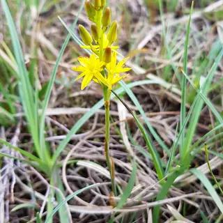 Clara Bog Nature ReserveBog · ClaraOne of the last raised bogs left in western Europe, crossed by a boardwalk, with the visitor centre in the town.
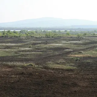 Croghan HillViewpoint · RhodeA volcanic plug stands on its own out of the Bog of Allen, with a burial mound on the top.
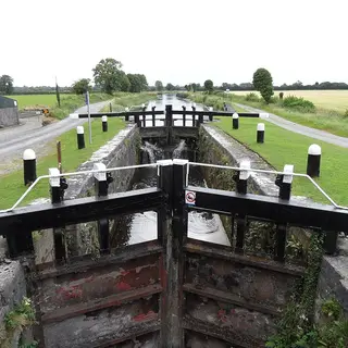 Grand Canal GreenwayGreenway · TullamoreThe canal towpath runs the whole width of the county and is flat the whole way, so you can take it in sections.
Westmeath8 places
- Hill of UisneachViewpoint · BallymoreUisneach is taken as the symbolic centre of Ireland, with a large split boulder near the top.
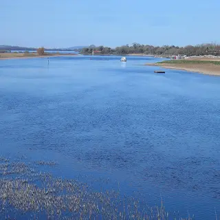 Lough ReeLake · AthloneThe lake widens out on the Shannon north of Athlone, with islands, harbours and boats on it the whole summer.
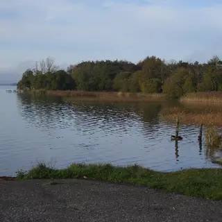 Lough EnnellLake · MullingarLough Ennell sits south of Mullingar with a beach at Lilliput, and a shore walk comes down to it from Belvedere.
 Lough DerravaraghLake · CastlepollardThe lake runs long and narrow under Knockeyon, and the story of the Children of Lir is set on it.
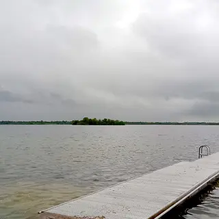 Lough OwelLake · MullingarClear limestone water just north of Mullingar, with a small island in it holding an early church site.
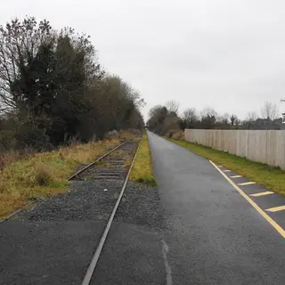 Old Rail Trail GreenwayGreenway · Athlone to MullingarForty kilometres of path on the old Dublin to Galway railway line, flat the whole way across the county.
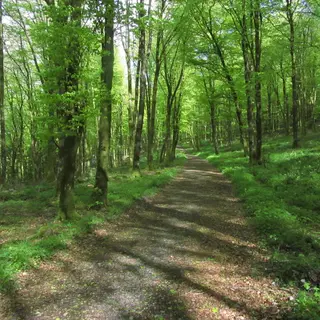 Mullaghmeen ForestForest · CastlepollardIreland's largest planted beech wood sits on the Meath border, with trails going up to the summit.
- Dún na Sí Amenity and Heritage ParkPark · MoateThe heritage park outside Moate has a reconstructed ringfort, a mass rock and walking trails.
Wexford24 places
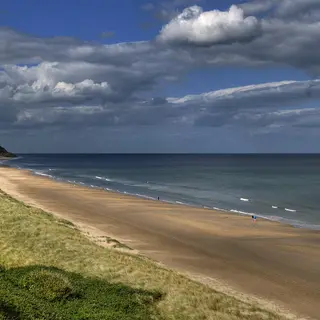 Curracloe BeachBeach · CurracloeThe dune-backed strand runs north of Wexford town. The landing scenes in Saving Private Ryan were shot on it.
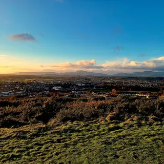 Vinegar HillViewpoint · EnniscorthyThe Wexford rebels were beaten on Vinegar Hill in June 1798. A windmill stump stands on top, with Enniscorthy below it.
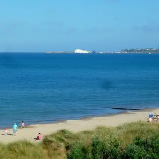 Rosslare StrandBeach · RosslareWide sandy beach on the southeast corner of the county, sheltered by the point at the end of it.
21 more from Fáilte Ireland’s listings
- Ballymoney North BeachBeach · BallymoneyBallymoney North Beach in Ballymoney, County Wexford is a very popular beach with locals and visitors alike.
- Shelmalier Forth MountainHeadland or viewpoint · BarntownShelmalier Forth Mountain is a public green area in Barntown County Wexford.
- Cahore Point BeachBeach · CahoreCahore Point Beach is located just beside the rural village of Cahore, County Wexford and is a which has a pier at one end.
- Glascarrig BeachBeach · CahoreIdeal for the enthusiastic fishing person or for a family day by the sea.
- CarneBeach · CarnaCarne Beach is a level sandy beach adjacent to Carne Pier which faces east towards the Irish Sea.
- Kilmichael StrandBeach · CastletownKilmichael Strand is quite a long beach located after Clones Strand in Castletown, County Wexford.
- Kilpatrick BeachBeach · CastletownKilpatrick Beach can be found next to Kilmichael Strand in Castletown, County Wexford.
- Roney Point BeachBeach · CourtownRoney Point Beach is located in Courtown, County Wexford and is home to a famous family of seals.
- Ballinesker BeachBeach · CurracloeBallinesker Beach is a 5km section of a longer stretch of sandy coastline extending from the Special Area of Conservation at Raven Point in County Wexford, to Ballyconniger Head.
- Culleton’s Gap BeachBeach · CurracloeCulleton’s Gap Beach is a peaceful stretch of golden sand located just north of Curracloe village in County Wexford.
- Ballyteigue StrandBeach · Kilmore QuayBallyteigue Strand lies west of Kilmore Quay, County Wexford.
- Ardamine BeachBeach · MiddletownArdamine Beach is located just around the rocks from Courtown's South Beach in County Wexford.
- Poulshone BeachBeach · PoulshonePoulshone Beach is situated about mile south of Courtown, county wexford.
- Rosslare Harbour BeachBeach · Rosslare HarbourRosslare harbour beach is located immediately south of Rosslare Euro Port.
- St. Helen's Bay BeachBeach · Rosslare HarbourSt Helen’s Bay in County Wexford has a long, sweeping sandy beach perfect for swimming, fishing, sailing, and leisurely walks.
- Baginbun BeachBeach · Co. WexfordBaginbun Beach, near Fethard-on-Sea in County Wexford, is a sheltered sandy cove perfect for families seeking a peaceful seaside escape.
- Ballyhealy BeachBeach · Co. WexfordBallyhealy Beach, near Kilmore in County Wexford, is a quiet, scenic spot ideal for families and nature lovers.
- Carnivan BeachBeach · Co. WexfordCarnivan Beach is located in Fethard, County Wexford and is suitable for more experienced swimmers and ideal for surfing.
- Courtown BeachBeach · Co. WexfordCourtown Beach is located approximately 6km south east of Gorey, County Wexford.
- Cullenstown StrandBeach · Co. WexfordCullenstown Strand is a long stretch of sandy beach located quite near the village of Cullenstown, Co Wexford.
- MorriscastleBeach · Co. WexfordMorriscastle Beach has a wealth of secluded coves and a natural bay extending over 5km.
Wicklow15 places
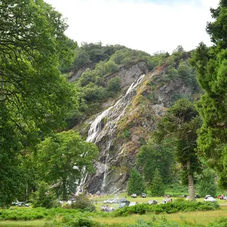 Powerscourt WaterfallWaterfall · EnniskerryIreland's highest waterfall drops 121 metres, in parkland a few kilometres from the main estate.
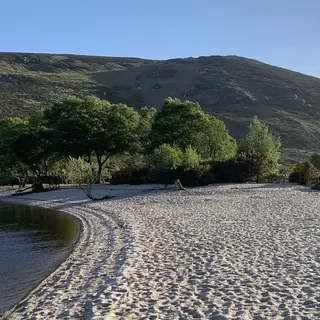 Wicklow Mountains National ParkNational park · LaraghOver 20,000 hectares of blanket bog, heath and upland woodland across the middle of the county.
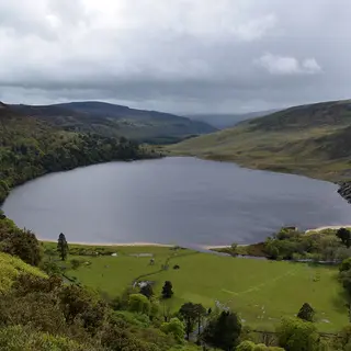 Lough TayLake · RoundwoodThe lake is dark with a white sand beach at one end of it, seen from a pull in on the Sally Gap road.
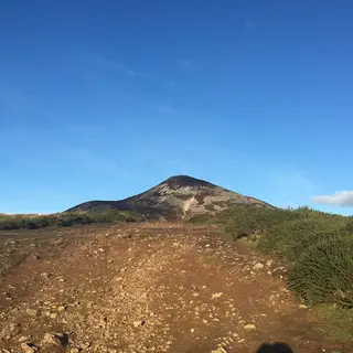 Great Sugar LoafMountain · KilmacanogueThe quartzite cone stands over the N11. You can be up and down inside an hour from the car park.
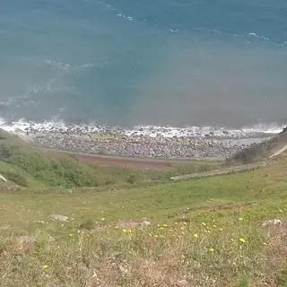 Bray HeadWalk · BrayThe hill at the south end of the promenade, with a cross on top and a path up from the town. The cliff walk round to Greystones has been closed since 2021 after landslides and stays closed for years yet.
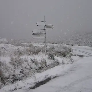 Sally GapViewpoint · RoundwoodA crossroads at five hundred metres on the old Military Road, with open bog in every direction from it.
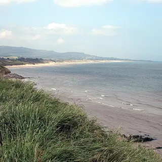 Brittas BayBeach · Co. WicklowFive kilometres of sand behind a dune system, and the main beach on the Wicklow coast.
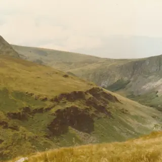 GlenmalureWalk · RathdrumGlenmalure runs long and straight under Lugnaquilla, with a waterfall at the head of it.
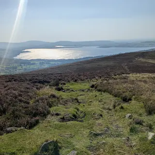 Blessington LakesLake · BlessingtonThe reservoir west of the mountains has a shore walk and sailing on it, and a village underneath the water.
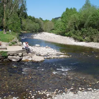 Meeting of the WatersRiver · AvocaWhere the Avonmore and the Avonbeg run into each other, which a Thomas Moore song made famous.
5 more from Fáilte Ireland’s listings
- Arklow South BeachBeach · ArklowArklow Beach, located on the scenic southeast coast of County Wicklow, offers a peaceful escape with its long sandy shoreline and views of the Irish Sea.
- Sculpture In WoodlandForest park · AshfordThe Devil's Glen was chosen as the location for Sculpture in Woodland because of its rich historic, artistic and natural heritage.
- Bray South Promenade BeachBeach · Bray
- Beyond the Trees AvondaleForest park · Rathdrum
- Parnell National Memorial ParkPark · RathdrumAlso found here is the Feagh McHugh O'Byrne Commemorative Stone, remembering another Wicklow native who influenced the course of Irish history.
Munster
Clare22 places
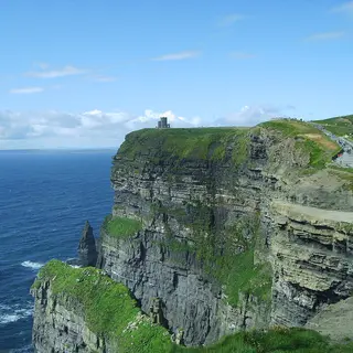 Cliffs of MoherCliffs · LiscannorSea cliffs run about 14km down the west Clare coast, and the visitor centre is dug into the hillside above Liscannor.
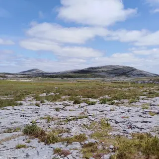 Burren National ParkNational park · CorofinLimestone pavement, hazel scrub and lakes that come and go south of Mullaghmore. The waymarked trails start at Gortlecka crossroads, which has no parking, so start from the information point in Corofin.
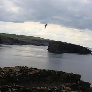 Kilkee CliffsCliffs · KilkeeCliffs and sea stacks west of Kilkee bay, with a signed cliff path that starts in the town itself.
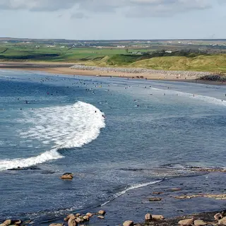 Lahinch BeachBeach · LahinchThe beach fills Liscannor Bay at the edge of the town, with a promenade behind it and a links course beyond that.
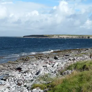 Flaggy ShoreWalk · BallyvaughanLow limestone shoreline at New Quay on the north Burren coast, walked as a road loop past Lough Murree.
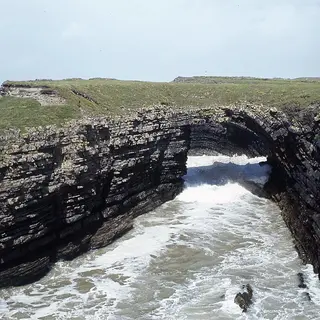 Bridges of RossCliffs · KilbahaThree sea arches named the spot and one is left, in the cliffs on the north side of Loop Head.
16 more from Fáilte Ireland’s listings
- Doon ForestForest park · BroadfordDoon is located about 3.5km northwest of Broadford, County Clare.
- Burren Experience Guided WalksNational park · CorofinWith your local guide, gain access to areas of beauty which are otherwise inaccessible to visitors.
- Cratloe WoodsForest park · CratloeCratloe Wood is a state owned forest on the slopes of Woodcock Hill, beside the small village of Cratloe in County Clare.
- Dromore Wood Nature Reserve & Visitor CentreForest park · EnnisDromore Wood Nature Reserve, near Ennis in County Clare, was established as a nature reserve because of the diversity and richness of its flora and fauna.
- MurrooghtoohyBeach · FanoreDespite sharing the rocky 'lunar' landscape of The Burren, Murrooghtoohy has its own distinctive flora (such as maiden fern) that flourishes in bordered gullies known as 'grykes'.
- Cahermurphy ForestForest park · FeakleAdjacent to the village of Flagmount in County Clare, on the shores of Lough Graney, lies Cahermurphy Forest.
- Kilkee BeachBeach · KilkeeThe crescent shaped beach at Kilkee in County Clare is a stretch of golden sand that slightly slopes toward the sea, and is a popular holiday spot during the summer months.
- Cappa PierIsland or harbour · KilrushCappa Pier is a small stoney beach located in Kilrush, County Clare.
- Mountshannon, Lough DergLake or river · MountshannonMountshannon is a small lakeside bathing area located at Lough Derg in Mountshannon, County Clare.
- Seafield BeachBeach · QuiltySeafield Beach and Pier is located just south west of the village of Quilty, Co Clare.
- Spanish PointBeach · Spanish PointSpanish Point is located on the R482 road between Miltown Malbay and Quilty, with unrestricted views of the Atlantic Ocean.
- Ballycuggeran BeachBeach · Co. ClareBallycuggeran is a small lakeside bathing area located at Lough Derg in County Clare.
- Carrigaholt BeachBeach · Co. Clare
- Doughmore BayBeach · Co. ClareSaunter down the 4.5km sandy beach of Doughmore Bay and breathe in the crisp, fresh sea air.
- White Strand DoonbegBeach · Co. ClareThe beach is lifeguard patrolled during the summer months and more information can be found at the notice board located at the beach.
- White Strand Miltown MalbayBeach · Co. ClareWhite Strand Miltown is a relatively small, sandy beach with a rocky shoreline.
Cork31 places
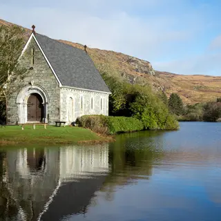 Gougane BarraForest · BallingearyA stone oratory sits on an island in the lake, with forest trails and mountain road all around it.
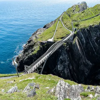 Mizen HeadCliffs · GoleenIreland's southwest tip, reached by an arched bridge over the water between two cliffs.
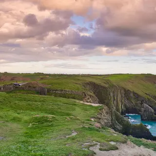 The Old Head of KinsaleCliffs · KinsaleA long headland running out into the Atlantic. The end of it is a private golf course, so most people see it from the signal tower at the neck.
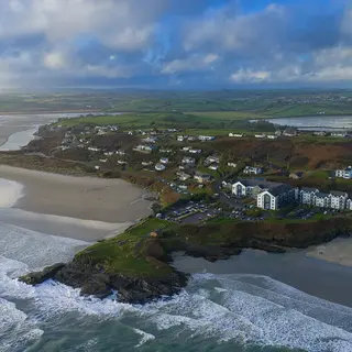 Inchydoney BeachBeach · ClonakiltyTwo halves of sand either side of a headland, joined to the mainland by a causeway near Clonakilty.
27 more from Fáilte Ireland’s listings
- Regional Park BallincolligPark · BallincolligThe Regional Park Ballincollig is located on the South bank of the River Lee and much of it lies on the river’s floodplain.
- Glengarriff Woods Nature ReserveForest park · GlengarriffGlengarriff Woods are situated in a deep rough glacial valley which opens out into the north side of Bantry Bay near Glengarriff village, County Cork.
- Inch StrandBeach · InchInch Strand is an expansive beach located in Whitegate, County Cork.
- Farran Forest ParkForest park · MacroomFarran Forest is an area of approximately 44 hectares situated on the banks of the Lee reservoir in County Cork.
- Rocky Bay BeachBeach · NohovalRocky Bay Beach, tucked away near Minane Bridge in County Cork, is a small but scenic cove known for its golden sand and rugged cliffs.
- Oysterhaven BeachBeach · OysterhavenSheltered by surrounding hills, it’s ideal for kayaking, sailing, and paddleboarding, with an outdoor activity centre nearby.
- Ring BeachBeach · RingRing Beach is a lovely sandy beach, located approximately 3.5 kilometres from Ballymacoda, County Cork.
- Silver Strand, Sherkin IslandBeach · Sherkin IslandSilver Strand is a gently sloping sandy beach open to the south west.
- Redbarn BeachBeach · YoughalRedbarn Beach is located in Youghal, County Cork.
- Youghal Front StrandBeach · YoughalYoughal Front Strand Beach is located in Youghal, County Cork.
- Youghal, Claycastle BeachBeach · YoughalYoughal, Claycastle Beach is located near the heritage walled town of Youghal in County Cork.
- Ardnahinch Beach, ShanagarryBeach · Co. CorkArdnahinch Beach is located near Shanagarry in County Cork.
- Ballynamona BeachBeach · Co. CorkIt is sandy and sheltered and popular with walkers and surfers.
- Ballyrisode BeachBeach · Co. CorkBallyrisode Beach, can be found 11km west of Schull Town.
- Cadogan's StrandBeach · Co. CorkCadogan's Strand is located close to Schull Town in County Cork.
- Dooneen Pier BeachBeach · Co. Cork
- Fitzgerald's ParkPark · Co. CorkFitzgerald's Park is the original site of the 1902 International Exhibition held in Cork and named after Lord Mayor, Edward Fitzgerald.
- Fountainstown BeachBeach · Co. CorkFountainstown Beach is ideally located in Fountainstown, County Cork.
- Galley Cove BeachBeach · Co. CorkGalley Cove is located at Crookhaven in County Cork.
- Galley Head ViewHeadland or viewpoint · Co. Cork
- Garnish Beach, LehanmoreBeach · Co. CorkGarnish Beach is located at the southern tip of the Beara Peninsula, West Cork.
- Garrettstown BeachBeach · Co. CorkGarretstown Beach is an expansive sandy beach located along the coast of County Cork.
- Garrylucas, White StrandBeach · Co. CorkGarrylucas, White Strand is a sandy beach located at the Old Head of Kinsale, in County Cork.
- Owenahincha, Little Island StrandBeach · Co. CorkOwenahincha, Little Island Strand is a Blue Flag awarded sandy beach backing onto sand dunes, and is located near Rosscarbery in County Cork.
- Red StrandBeach · Co. CorkRed Strand is a small beach located in a horseshoe bay near Rosscarbery in County Cork.
- Tragumna BeachBeach · Co. CorkTragumna Beach is a small, scenic, sheltered, sandy beach located in Skibbereen, County Cork.
- Warren BeachBeach · Co. CorkWarren Beach is a small, rural sandy beach located at the mouth of Rosscarbery River in County Cork.
Kerry31 places
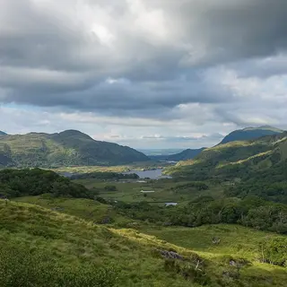 Killarney National ParkNational park · KillarneyLakes, oak woodland and mountain on the edge of the town, with paths that start at the gate.
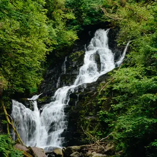 Torc WaterfallWaterfall · KillarneyThe waterfall is a short walk from the road, and steps climb from it to a view over the lakes.
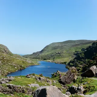 The Gap of DunloeMountain · BeaufortOne road runs through the middle of this narrow pass between Purple Mountain and the Reeks.
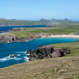 Slea HeadCliffs · DingleOut at the western tip of the Dingle peninsula, with the Blasket Islands sitting in front of you.
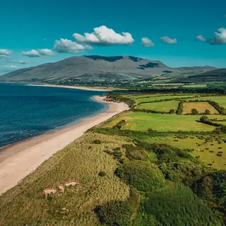 Castlegregory BeachBeach · CastlegregoryA long strand on the north side of the Dingle peninsula, dunes behind it and Brandon Bay beyond.
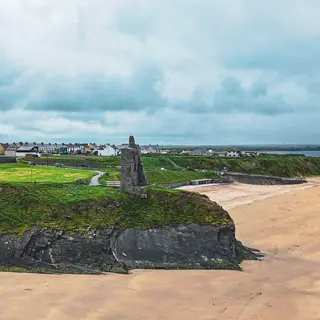 BallybunionBeach · Co. KerryTwo beaches split by a headland with a castle ruin on it, on the north Kerry coast.
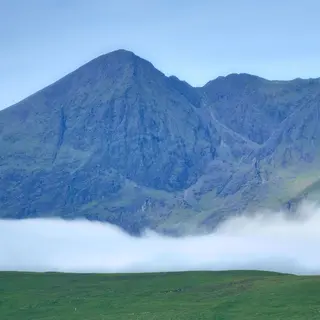 MacGillycuddy's ReeksMountain · KillarneyIreland's highest range runs west from Killarney, with Carrauntoohil in the middle of it.
24 more from Fáilte Ireland’s listings
- Baile an Sceilg (Ballinskelligs) BeachBeach · BallinskelligsBaile an Sceilg (Ballinskelligs) beach is an extensive sandy beach located in a rural environment just 2km south of the village of Dungeagan in County Kerry.
- Srón Bhroin (Brandon Point)Beach · BrandonBrandon Point is a mere 5km drive from Cloghane village.
- Camp BeachBeach · CampCamp is a small village located near the Slieve Mish Mountains in County Kerry.
- Clogher BeachBeach · DingleClogher Beach is about 12km west of Dingle Town along the Slea Head Drive in County Kerry.
- Fenit MarinaIsland or harbour · FenitWatch the ships come in at Fenit Marina in County Kerry.
- Mountain StageHeadland or viewpoint · GlenbeighLocated along the N70 road, the Mountain Stage layby offers the perfect photo opportunity for all visitors.
- Gleninchaquin ParkForest park · KenmareVisitors can enjoy a variety of walking trails through streams and woodlands with scenic viewpoints along the way.
- Muckross And Dinis TourNational park · KillarneyTake the Killarney to Kenmare road to the main entrance to the National Park.
- Waterville BeachBeach · WatervilleWaterville Beach is situated on the seafront of Waterville and overlooks Ballinskelligs Bay, Bolus Head on the right and Hog's Head to the left.
- Ballybunion NorthBeach · Co. KerryBallybunion North Beach is an extensive sandy beach located near the town of Ballybunion in County Kerry.
- Ballybunion SouthBeach · Co. KerryBallybunion South Beach is an extensive sandy beach close to the town of Ballybunion in County Kerry.
- Béal Bán BeachBeach · Co. KerryIts name means White Mouth, reflecting the pale sands and gentle waves that make it perfect for paddling, walking, and relaxing.
- Beale StrandBeach · Co. KerryStroll the 3km rocky, sandy beach of Beale Strand in County Kerry around the 'dog-leg' of the Shannon estuary.
- Doire Fhíonáin (Derrynane)Beach · Co. KerryDerrynane, Doire Fhíonáin is an extensive sandy beach in Derrynane Bay, County Kerry.
- Dooks BeachBeach · Co. KerryDooks Beach is a coastal beach just a short distance from Glenbeigh Village in County Kerry.
- Fermoyle StrandBeach · Co. KerryOne of the longest beaches in Ireland, Fermoyle Strand makes up part of the sweeping curve of Brandon Bay on the northern side of the Dingle Peninsula.
- InchBeach · Co. KerryTake a walk along the famous strand, or take part in water activities like sea angling, surfing and more.
- KilmakillogeBeach · Co. KerryStop by Kilmakilloge in County Kerry and enjoy fine views of the Kenmare River and the surrounding area of the Beara Peninsula.
- Kinard BeachBeach · Co. Kerry
- Littor BeachBeach · Co. KerryLittor is a small beach situated on the southern shore of the Shannon Estuary, in North County Kerry.
- MaharabegBeach · Co. KerryMaharabeg Beach in County Kerry has a very extensive sandy beach and dune system.
- Murreagh BeachBeach · Co. KerryOne of many sandy beaches surrounding Smerwick Harbour in County Kerry, Murreagh Beach is popular amongst walkers and is also safe for swimming.
- Ballyheigue BeachBeach · BallyheigueA long sandy beach below the village of Ballyheigue in north Kerry, running south towards Banna Strand.
- Banna StrandBeach · BannaA long strand backed by high dunes, where Roger Casement came ashore from a German submarine in 1916.
Limerick9 places
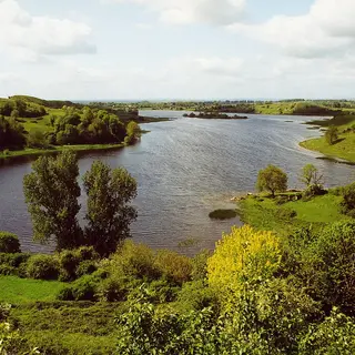 Lough GurLake · BruffLough Gur is a horseshoe of water south of the city, ringed with prehistoric remains, with a visitor centre at the shore.
- Limerick GreenwayGreenway · Newcastle WestSurfaced on the old Limerick to Tralee railway line, running from Rathkeale through Newcastle West to Abbeyfeale.
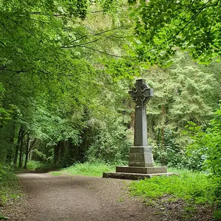 Curraghchase Forest ParkForest · AskeatonWoodland and parkland near Askeaton with walking trails, a lake, and the burnt-out shell of the de Vere house.
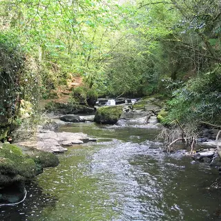 Clare GlensWaterfall · MurroeThe wooded river gorge near Newport straddles the Tipperary border, with a looped path past waterfalls on the Clare River.
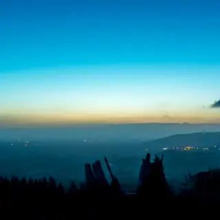 Ballyhoura MountainsMountain · KilfinaneLow hills on the Cork border near Kilfinane, carrying a large network of mountain bike trails.
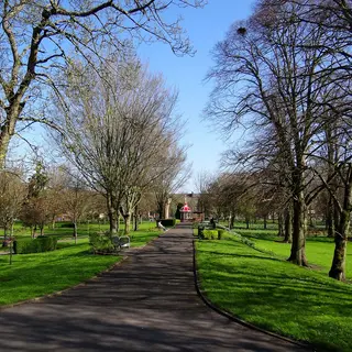 People's ParkPark · LimerickThe Victorian park beside Pery Square has a bandstand and a memorial column in it.
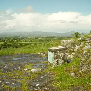 Slieve Felim WayWalk · MurroeThe route goes over the hills from Murroe in Limerick to Silvermines in Tipperary.
2 more from Fáilte Ireland’s listings
- Arthur's Quay ParkIsland or harbour · Limerick City
- Galty Castle WoodCastle or house · Co. LimerickGalty Castle Wood is a public recreation space located about 2km north of Skeheenarinky, in County Limerick.
Tipperary8 places
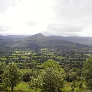 Glen of AherlowWalk · Tipperary townAherlow runs between the Galtees and the Slievenamuck ridge, with a nature park and trails at Newtown.
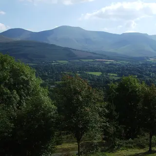 Galtee MountainsMountain · CahirA sandstone range on the Limerick border, with Galtymore the high point at 918 metres.
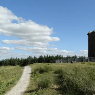 Devil's BitMountain · TemplemoreThe gap in the rock ridge above Templemore is reached by a looped hill walk from the car park at the foot of it.
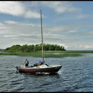 Lough DergLake · NenaghThe largest lake on the Shannon. The Tipperary shore runs south from Terryglass to Ballina, across the bridge from Killaloe.
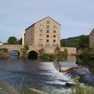 Suir Blueway TipperaryGreenway · ClonmelSurfaced towpath along the Suir between Clonmel and Carrick-on-Suir, with a marked paddling route on the water beside it.
3 more from Fáilte Ireland’s listings
- Caher ParkForest park · CahirCaher Park is situated on the limestone escarpment which rises above the Suir Valley, in County Tipperary.
- Golden Grove ForestForest park · RoscreaGolden Grove is a pleasant woodland area about 3.5km from Roscrea, in County Tipperary.
- GortavoherForest park · Co. TipperaryGortavoher forest is 5km south of Tipperary Town on the R664 road to the Glen of Aherlow.
Waterford17 places
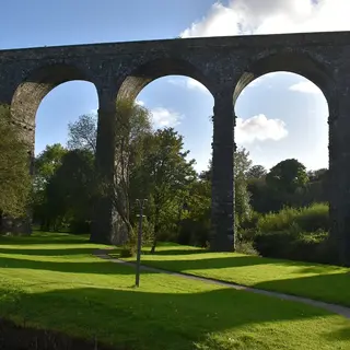 Waterford GreenwayGreenway · DungarvanForty-six kilometres on the old Waterford to Dungarvan railway, over three viaducts and through the Ballyvoyle tunnel.
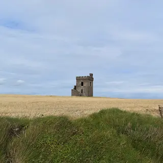 Ardmore Cliff WalkWalk · ArdmoreAbout 5km of coast loop from the village around Ram Head, past a wrecked crane ship and a holy well.
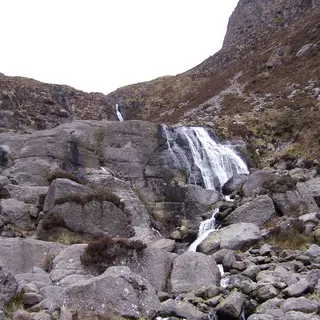 Mahon FallsWaterfall · DungarvanThe waterfall comes down the sandstone face of Coumahon in the Comeraghs, about twenty minutes on foot from the car park.
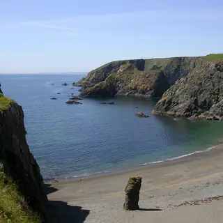 Copper Coast GeoparkCliffs · DungarvanCoves, sea stacks and what is left of the nineteenth century copper mines, on the coast between Tramore and Dungarvan.
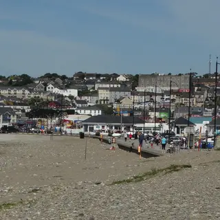 Tramore BeachBeach · TramoreLong sandy strand backed by dunes, south of Waterford city.
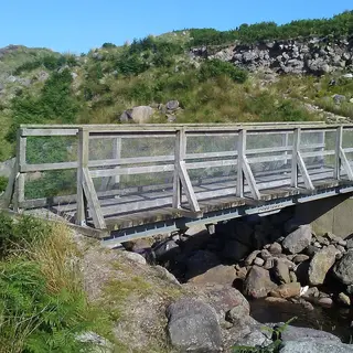 Nire Valley Coumduala LoopWalk · BallymacarbryWaymarked hill walk from the Nire car park up into the Comeragh corries above Ballymacarbry.
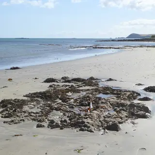 Clonea BeachBeach · DungarvanSandy beach on Dungarvan Bay a few kilometres east of the town.
10 more from Fáilte Ireland’s listings
- Ardmore BeachBeach · ArdmoreArdmore Beach in County Waterford is a sweeping beach and popular with families because of its safe bathing waters.
- Ballyquin BeachBeach · ArdmoreBallyquin Beach are located just outside Ardmore in County Waterford.
- Counsellors' Strand, Dunmore EastBeach · Dunmore EastLocated approximately 15km south east of Waterford City, County Waterford, Counsellors' Strand, Dunmore East beach is in a small sheltered cove, enjoyed by both the locals and tourists.
- Waterford Nature ParkPark · Waterford CityWaterford Nature Park is an oasis of approximately 150 acres, located near Waterford City, in County Waterford.
- Woodstown BeachBeach · WoodstownWoodstown Beach is a safe and sandy beach located approximately 12km from Waterford City.
- Ballyscanlon ForestForest park · Co. WaterfordBallyscanlon Forest is located 6.5km west of Tramore on the road to Dungarvan in County Waterford.
- Curragh BeachBeach · Co. Waterford
- Goat Island BeachBeach · Co. WaterfordThis sheltered cove offers golden sands, scenic coastal views, and a peaceful atmosphere perfect for swimming, walking, or relaxing.
- Kilfarrassey BeachBeach · Co. WaterfordKilfarrassy Beach is located on the south east coast of the county and is 7 km west of Tramore town.
- Whiting Bay BeachBeach · Co. WaterfordInishturk Island is accessed by ferry from Roonagh Pier in County Mayo or Cleggan in County Galway.
Connacht
Galway26 places
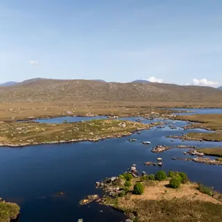 Connemara National ParkNational park · LetterfrackBog, heath and mountain on the northwest coast, with waymarked trails climbing Diamond Hill.
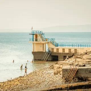 Salthill PromenadeWalk · SalthillThe seafront walk runs along Galway Bay, with the Burren across the water and the diving tower at the end.
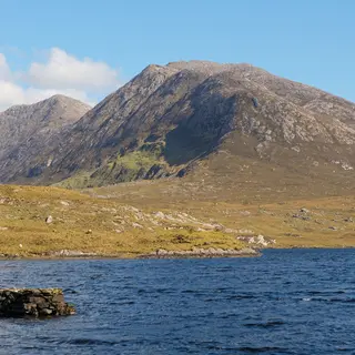 The Twelve BensMountain · ConnemaraQuartzite peaks behind Clifden, with walking routes of every length going into them.
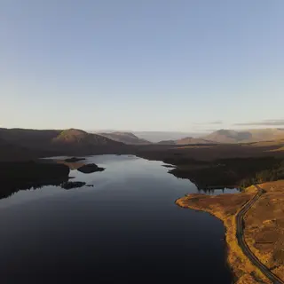 Lough InaghLake · ConnemaraThe lake fills the valley between the Twelve Bens and the Maumturks, with the road running along one shore.
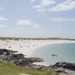 Dog's Bay BeachBeach · RoundstoneWhite shell sand in a horseshoe, on a narrow neck of land west of Roundstone.
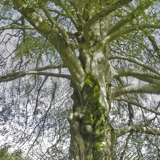 Coole ParkPark · GortLady Gregory's house stood on this wooded estate outside Gort. The autograph tree and the lake walks are still there.
20 more from Fáilte Ireland’s listings
- Dumhach BeachBeach · Inishbofin
- Loughrea LakeLake or river · LoughreaLoughrea Lake is located in Loughrea, County Galway.
- Islands ViewBeach · RenvyleOn the north coast of the Renvyle Peninsula, Islands View is so named because it's the ideal spot from which to see Crump and the other islands in the bay.
- Gurteen BeachBeach · RoundstoneTwo miles from Roundstone, Co Galway, on the road to Clifden, are two of the finest beaches in Ireland.
- Salthill BeachBeach · SalthillSalthill Beach is located approximately 2km from Galway City and is made up of several small beaches which are separated by rocky outcrops.
- Silver Hill/Aillebrack BeachBeach · SilverhillSilver Hill/Aillebrack Beach, 5km west of Ballyconneely in County Galway, is a peaceful, family friendly beach along the Wild Atlantic Way.
- An Trá Mór, Coill Rua, IndreabhánBeach · Co. GalwayAn Trá Mór, Coill Rua, Indreabhán is a sandy beach located in the Gaeltacht area of Inveran, County Galway.
- Bathing Place at PortumnaBeach · Co. GalwayBathing Place at Portumna is situated at the head of Lough Derg about 1.5km south of Portumna Town.
- Céibh an Spidéal BeachBeach · Co. GalwayGalway Bay is a west facing bay, open to the Atlantic.
- Cill Mhuirbhigh, Inis MórBeach · Co. GalwayCill Mhuirbhigh, Inis Mór is a sandy beach located on the northern coast of Inishmore Island.
- Inis Meáin (Inishmaan)Beach · Co. GalwayEscape the noise of the modern world and experience Inishmaan (Inis Meáin), a place where beauty, tradition and culture combine in a rugged windswept landscape.
- Omey IslandIsland or harbour · Co. GalwayThis vast beach reveals itself every day at low tide, when it also serves as the access point to Omey Island.
- Renvyle BeachBeach · Co. GalwayFramed by aquamarine waters and views of the Twelve Bens mountains, it’s perfect for swimming, walking, and relaxing in nature.
- Rinville ParkPark · Co. GalwayBe sure to keep an eye out for the wildlife that have made Rinville Park their home, such as ravens, grey herons and otters, and stop and smell the park's wildflowers.
- Seanchéibh an SpidéilBeach · Co. Galway
- Silver Strand BeachBeach · Co. GalwaySilver Strand Beach is located in Barna, County Galway.
- Trá an Dóilín, An Ceathrú RuaBeach · Co. GalwayTrá an Dóilín, An Ceathrú Rua is situated just outside the village of Carraroe in County Galway.
- Trá Inis OírrBeach · Co. GalwayTrá Inis Oírr is on the northern coast of Inis Oírr (Inisheer).
- Trá na gCeann (Silver Strand)Beach · Co. Galway
- Traught, KinvaraBeach · Co. GalwayOn a sunny day, stroll along the coastline of Traught beach in County Galway and take in far off views of Galway City.
Leitrim4 places
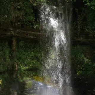 Glencar WaterfallWaterfall · ManorhamiltonGlencar drops into a wooded glen above the lough, a few minutes on foot from the car park.
- Acres Lake BoardwalkWalk · DrumshanboThe boardwalk floats along the edge of Acres Lake outside Drumshanbo, part of the Shannon Blueway.
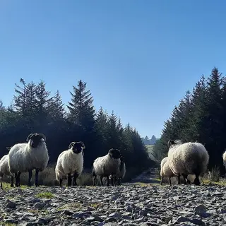 Leitrim WayWalk · ManorhamiltonThis waymarked trail runs about 59km from Manorhamilton Castle south through Dowra to the marina at Leitrim village, over bog and hill.
- SLNCR Greenway, DromahairGreenway · DromahairA short stretch of the old Sligo, Leitrim and Northern Counties Railway at Dromahair, with a 5km loop through the village. It is the first piece of a planned greenway from Sligo to Enniskillen.
Mayo34 places
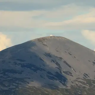 Croagh PatrickMountain · WestportCroagh Patrick stands over Clew Bay, and the climb from Murrisk goes up to a chapel on the 764 metre summit.
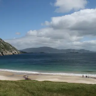 Keem BayBeach · AchillKeem is a horseshoe of beach at the west end of Achill, down a cliff road out of Keel.
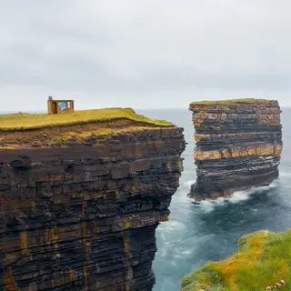 Downpatrick HeadCliffs · BallycastleThe headland is grass on top, with the Dún Briste sea stack standing just off it.
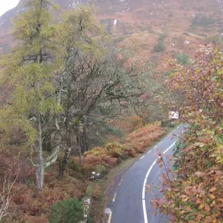 Great Western GreenwayGreenway · WestportAbout 42km of traffic-free cycling and walking on the old Westport to Achill railway line.
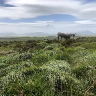 Wild Nephin National ParkNational park · BallycroyBlanket bog and the Nephin Beg range across northwest Mayo, with the visitor centre at Ballycroy.
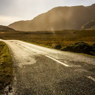 Doolough ValleyLake · LouisburghThe dark lake fills a pass on the R335, with a famine memorial cross standing at the roadside.
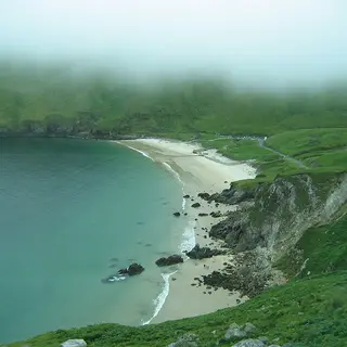 Keel BeachBeach · AchillKeel runs long on Achill, with the Minaun cliffs behind it.
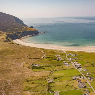 Minaun CliffsCliffs · AchillCliffs on the south side of Achill above Keel, with a road running up to a viewing point.
- Mayo Dark Sky ParkPark · BallycroyOut in the Nephin bog, a protected dark sky area with marked points to stand at after nightfall.
25 more from Fáilte Ireland’s listings
- Belleek WoodsForest park · BallinaThis peaceful woodland stretches for 6 miles making it one of the largest urban forests in Europe.
- Ballycroy Visitor Centre Wild Nephin National ParkMuseum or gallery · BallycroyThe Ballycroy Visitor Centre at Wild Nephin National Park, County Mayo, captivates visitors of all ages, providing insights into the park’s rich biodiversity and the cultural heritage of the region.
- Cross Beach, Erris PeninsulaBeach · BelmulletCross, Erris Peninsula Beach near Belmullet is located on the west coast of the Mullet Peninsula in County Mayo.
- Mayo Memorial Peace ParkPark · CastlebarThe Mayo Memorial Peace Park, in Castlebar County Mayo, commemorates the men and women of Mayo killed in the world wars of the last century.
- Cross Strand BeachBeach · CrossCross Strand Beach in County Mayo is a peaceful coastal escape south west of Louisburgh.
- Cross, Louisburgh BeachBeach · CrossCross Beach forms part of the Lough Cahasy, Lough Baun and Roonah Lough Special Area of Conservation (cSAC) proposed National Heritage Area (pNHA).
- Ross Beach, KillalaBeach · KillalaRoss Beach, Killala in County Mayo, is a sandy beach located in a rural environment.
- Carrowmore BeachBeach · LouisburghCarrowmore Beach is a sandy beach located in a special protection and conservation area and is perfect for walking and relaxing.
- White StrandBeach · Louisburgh
- Portacloy BeachBeach · Portacloy
- An Ceann Ramhar (Doohoma Head)Headland or viewpoint · Co. Mayo
- ClagganNational park · Co. MayoThis point in Claggan in north-west County Mayo offers panoramic views over Ballycroy National Park, south towards Claggan Mountain, and west, across the inlet, to Achill Island.
- Dooega Beach, Achill IslandBeach · Co. MayoDooega Beach, Achill Island is a small sheltered beach on the south side of Achill Island in County Mayo.
- Dugort Beach, Achill IslandBeach · Co. MayoDugort Beach, Achill Island, in County Mayo, is a small sandy beach located in the north of Achill Island overlooking Blacksod Bay.
- Elly Bay, BelmulletBeach · Co. MayoElly Bay, Belmullet is a Blue Flag sandy beach located a short distance south of Béal an Mhuirthead Belmullet in Erris, County Mayo.
- Golden Strand, Achill IslandBeach · Co. MayoGolden Strand, Achill Island is the largest of two beaches located in Dugort Village, on Achill Island, in County Mayo.
- Joyce Country and Western Lakes GeoparkForest park · Co. MayoThe Joyce Country and Western Lakes Geopark will shape the lives and stories of the generations to come.
- Mullaghroe Beach, BelmulletBeach · Co. MayoMullaghroe Beach, Belmullet is located 10km south of Béal an Mhuirthead Belmullet, in County Mayo.
- Mulranny BeachBeach · Co. MayoMulranny Beach is a sandy beach located southwest of Mulranny village in County Mayo.
- Oileán Chloigeann (Claggan Island)Island or harbour · Co. MayoWith a population of only 8 people, Claggan is Mayo's newest island, having only being officially declared an island in 1991.
- Old Head BeachBeach · Co. MayoOld Head Beach, Louisburgh in County Mayo is a sheltered, sandy beach that attracts swimmers and surfers alike.
- Silver StrandBeach · Co. MayoSilver Strand is sheltered by rocky headlands and high sand dunes.
- Spanish Armada ViewpointHeadland or viewpoint · Co. MayoThe Spanish Armada Viewpoint provides exceptional views of Clew Bay to the south and Clare Island to the south-west.
- Srah BeachBeach · Co. MayoKnown for its scenic beauty, it’s ideal for peaceful walks, swimming, and birdwatching.
- Termon BeachBeach · Co. MayoTermon Beach is located on the east coast of the Blacksod Mullet Peninsula approximately 0.5km south of Aghleam village Co Mayo.
Roscommon7 places
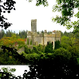 Lough Key Forest and Activity ParkPark · BoyleLough Key's forest park runs along the shore near Boyle, with a canopy walk up in the trees and wooded islands out on the water.
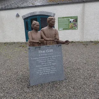 National Famine WayWalk · Strokestown165km of waymarked route from Strokestown to Dublin, on the road 1,490 tenants walked in 1847.
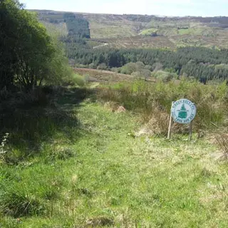 The Miner's Way and Historical TrailWalk · BoyleThe loop goes through the Arigna and Curlew hills, on the paths the miners used to get to work.
- Suck Valley WayWalk · CastlereaWaymarked loop along the River Suck on the Galway border.
- Derryvunny Old Woodland TrailForest · BoyleShort trail through old oak woodland on the shore of Lough Key.
- Kilronan Castle LoopWalk · BallyfarnonLooped walk through woodland above Lough Meelagh at Ballyfarnon.
Sligo16 places
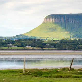 BenbulbenMountain · DrumcliffeBenbulben is flat on top, north of Sligo town, and a looped forest trail runs around the base of it.
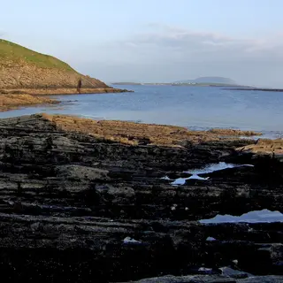 KnocknareaMountain · StrandhillThe cairn on top has never been opened. The Queen Maeve Trail takes you up from Strandhill.
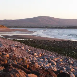 Strandhill BeachBeach · StrandhillThe surf beach west of Sligo town has a promenade behind it. The currents in the water are strong.
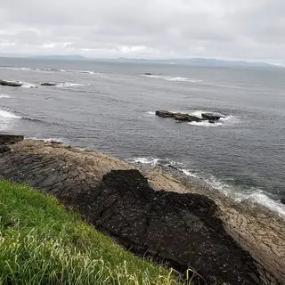 Mullaghmore HeadViewpoint · MullaghmoreA low headland with a small harbour on it, and a big wave break offshore.
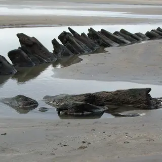 Streedagh BeachBeach · GrangeA long strand near Grange. Three Armada ships went down off it in 1588.
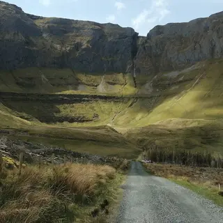 Gleniff HorseshoeViewpoint · CliffoneyThe road loops through a glacial valley in the Dartry mountains, with a cave up high on the rock face.
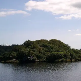 Lough GillLake · SligoLough Gill lies east of Sligo town and holds the small island Yeats named in his poem.
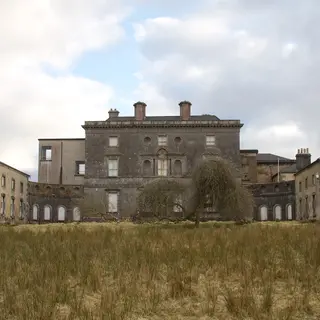 HazelwoodForest · SligoThe wooded peninsula on Lough Gill has a lakeside path with wooden sculptures standing along it.
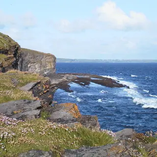 Aughris HeadCliffs · TempleboySmall headland with a cliff walk on it, on the coast between Sligo and Ballina.
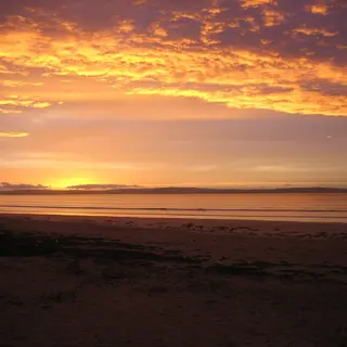 Enniscrone BeachBeach · EnniscroneLong sandy strand on Killala Bay at the west edge of the county.
- Slish WoodForest · SligoThe forest runs along the south shore of Lough Gill, with a marked walk down to the water.
5 more from Fáilte Ireland’s listings
- Mullaghmore BeachBeach · MullaghmoreMullaghmore is located between Cliffoney and Grange in County Sligo.
- Rosses Point BeachBeach · Rosses PointVisit Rosses Point Beach, a 2km stretch of fine sandy beach near Sligo Town.
- Dooney Rock ForestForest park · Co. SligoThis pleasant and leisurely nature trail is only 7km from Sligo Town on the R287.
- Doorly ParkForest park · Co. SligoDoorly Park is located along by the riverside in Sligo town, about a 15 minute walk from the town centre.
- Dunmoran StrandBeach · Co. SligoDunmoran Strand is near Easkey in County Sligo.
Ulster
Antrim9 places
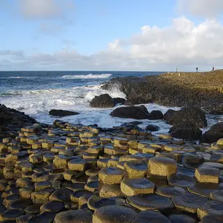 Giant's CausewayCliffs · BushmillsHexagonal basalt columns step down into the sea below the cliffs north of Bushmills, formed as lava cooled just under 60 million years ago. It became a World Heritage Site in 1986.
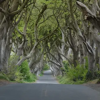 The Dark HedgesWalk · ArmoyJames Stuart planted this avenue of beech trees on Bregagh Road in 1775 as the approach to Gracehill House, and the branches have grown together over the road. The road is closed to cars, so park at the Hedges Hotel and walk the few minutes up.
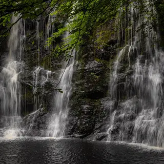 Glenariff Forest ParkForest · GlenariffA boardwalk first built about a hundred years ago runs down the river gorge past the waterfalls, and the viewpoint trail looks down the glen to the sea.
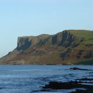 Fair HeadCliffs · BallycastleDolerite cliffs east of Ballycastle, the upper half made of giant columns, looking out towards Rathlin. The walks start from a farm car park and cross working farmland.
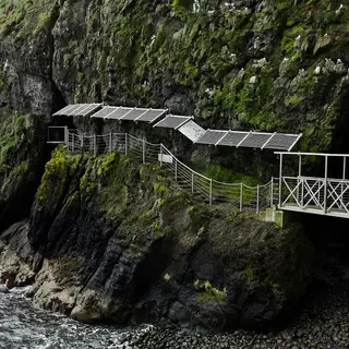 The GobbinsWalk · IslandmageeBerkeley Deane Wise opened a path along these Islandmagee cliffs in 1902, and after a rebuild it reopened in 2015 with new bridges over the sea. You go on a guided tour.
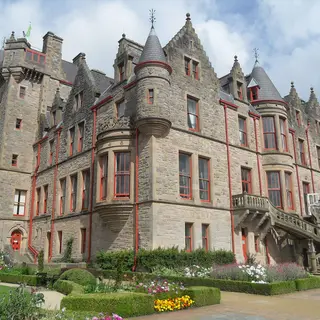 Cave Hill Country Park and Belfast CastlePark · BelfastThe park takes its name from five caves in the cliffs above north Belfast. Belfast Castle, finished in 1870, sits on the lower slopes and McArt's Fort is up on the cliff top.
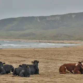 White Park BayBeach · BallintoyA white arc of sand between two headlands at Ballintoy, backed by old dunes. Cattle from a local farm wander along the beach at certain times of the year.
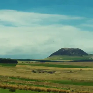 SlemishMountain · BroughshaneSt Patrick is said to have tended sheep on this lone hill east of Ballymena, and hundreds climb it on St Patrick's Day every year.
1 more from Fáilte Ireland’s listings
- Murlough BayBeach · Ballycastle
Armagh6 places
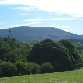 Slieve GullionMountain · MeighThe highest point in the county, with a forest drive up its side and a passage tomb on the summit, at the centre of the Ring of Gullion.
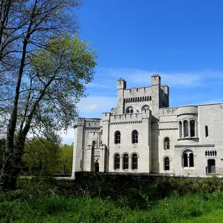 Gosford Forest ParkForest · MarkethillThe old demesne of the Earls of Gosford outside Markethill, now a forest park of woodland and parkland around the castle, with an arboretum and a walled garden.
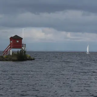 Oxford IslandNature reserve · LurganNot an island at all but a peninsula reaching into Lough Neagh near Lurgan, a national nature reserve of woodland and meadows with the Lough Neagh Discovery Centre.
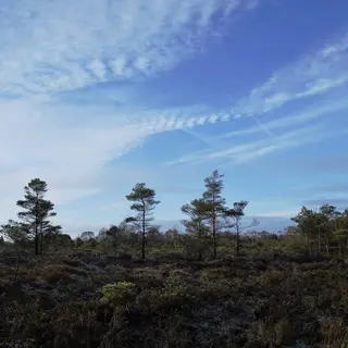 Peatlands ParkBog · MagheryLowland raised bog kept as a country park, where boardwalks cross a bog garden and the walks run on through woodland and old orchards.
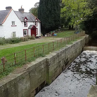 Newry Canal at Moneypenny's LockCanal · PortadownThe Newry Canal opened in 1742, and its towpath, now a walking and cycling route, passes the lock and lock-keeper's house at Moneypenny's Lock outside Portadown.
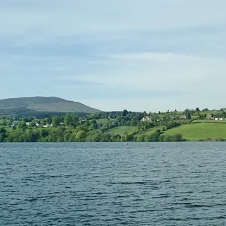 Camlough LakeLake · CamloughA glacial ribbon lake in the valley between Slieve Gullion and Camlough Mountain, and the largest lake in the Ring of Gullion.
Cavan10 places
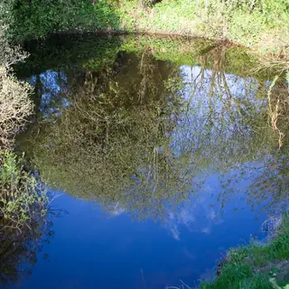 The Shannon PotRiver · GlangevlinA pool on the side of Cuilcagh is taken as the source of the Shannon, with a short marked trail around it.
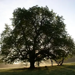 Dún a Rí Forest ParkForest · KingscourtMixed woodland along the Cabra river outside Kingscourt, with waterfalls, a wishing well and marked trails.
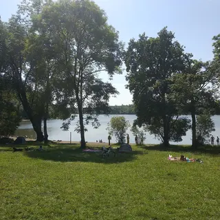 Killykeen Forest ParkForest · KilleshandraForest across the wooded islands and inlets of Lough Oughter, with a nature trail and paths along the water.
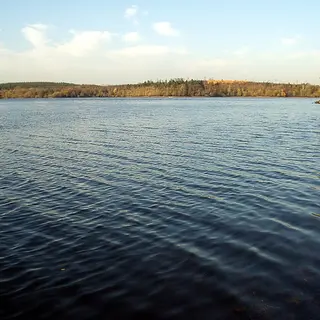 Lough OughterLake · KilleshandraSmall lakes and drumlin islands run into each other on this stretch of the Erne, fished and boated all summer.
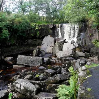 Tullydermot FallsWaterfall · SwanlinbarFalls on the Claddagh river about six kilometres southwest of Swanlinbar, inside the UNESCO geopark.
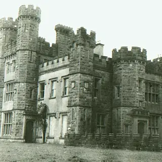 Castle Saunderson DemesnePark · BelturbetThe old Saunderson estate on the Fermanagh border near Belturbet, now a scout centre, with a short signed trail through the grounds.
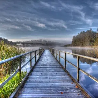 Castle LakeLake · BailieboroughCastle Lake is on the edge of Bailieborough, with a three kilometre and a seven kilometre forest loop around the shore.
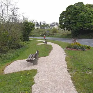 Killeshandra Lake and Forest WalkWalk · KilleshandraSix kilometres of waymarked loop by the forest and the lake shore, starting from the picnic areas on the Cavan and Belturbet roads out of Killeshandra.
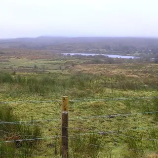 Gowlan Loop at Garvagh LoughWalk · BlacklionA looped walk right around Garvagh Lough at Moneygashel, a lake on limestone bedrock.
Derry8 places
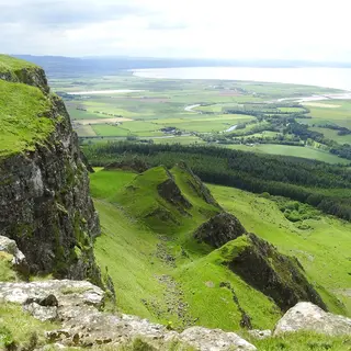 BinevenaghMountain · LimavadyThe cliffs of Binevenagh, formed from lava 60 million years ago, run above Benone Strand with Lough Foyle and Donegal in view. There is a small lake on the top.
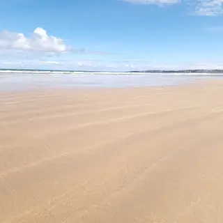 Portstewart StrandBeach · PortstewartThe National Trust looks after this long strand west of Portstewart, backed by dunes that are 6,000 years old. The Causeway Coast Way to Ballycastle starts here.
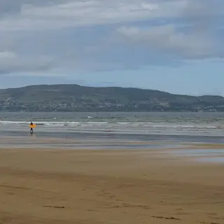 Benone StrandBeach · LimavadyFirm sand with no rocks or seaweed on it, running along under the Binevenagh cliffs with Donegal across the water. It has won the Blue Flag many times.
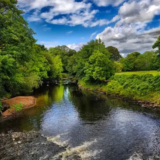 Roe Valley Country ParkPark · LimavadyWoodland walks follow the River Roe on the edge of Limavady, past the remains of the old industry that once used the river for power.
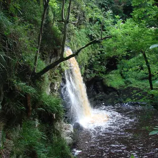 Ness Country ParkPark · ClaudyMixed woodland and open parkland on both banks of the Burntollet River, with riverside walks that take you to a waterfall.
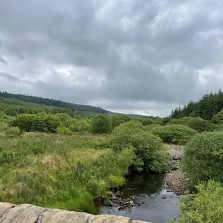 Banagher GlenNature reserve · DungivenOak and ash grow on the steep sides of the glen south of Dungiven, and a surfaced road runs up from the car park to the dam at Altnaheglish Reservoir.
2 more from Fáilte Ireland’s listings
Donegal30 places
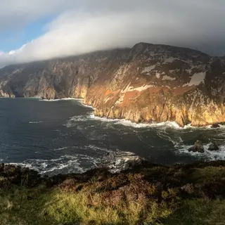 Sliabh Liag (Slieve League)Cliffs · CarrickSea cliffs on the southwest coast that rise to about 600 metres. Park at the visitor centre or the ranger station and walk or take the shuttle bus up to the viewing point; the path runs on along the ridge.
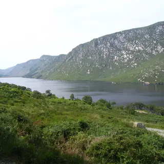 Glenveagh National Park and CastleNational park · ChurchillA glacial valley with a lake in it, red deer and a Victorian castle. The castle is a shuttle bus or a four kilometre walk.
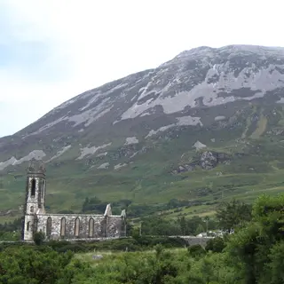 Mount ErrigalMountain · DunleweyThe quartzite cone above Dunlewey is 751 metres, and a marked path goes up from a car park on the R251.
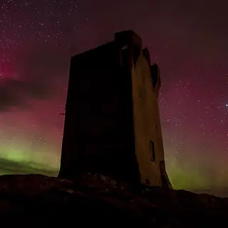 Malin HeadViewpoint · MalinIreland's most northerly point, with a signal tower, a car park and a cliff path down to Hell's Hole.
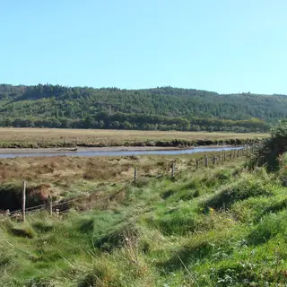 Ards Forest ParkForest · CreesloughWoodland on a peninsula in Sheephaven Bay, with marked trails, dunes and several small beaches inside it.
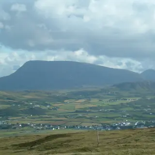 Muckish MountainMountain · CreesloughThe flat top above Creeslough is the shape you will remember, and an 8.3 kilometre bog and track loop runs around the foot of it.
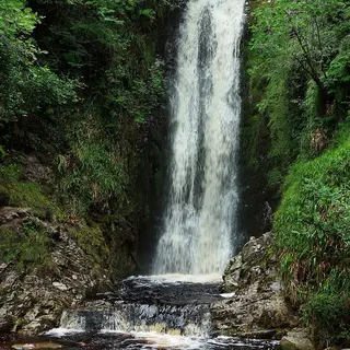 Glenevin WaterfallWaterfall · ClonmanyThirty feet of fall at the head of the Glenevin valley, on a signposted riverside path with footbridges.
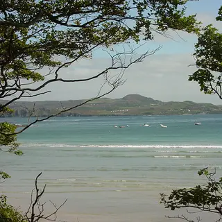 Marble Hill BeachBeach · DunfanaghySheltered sand between two headlands on Sheephaven Bay, near Port na Blagh.
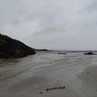 Carrickfinn BeachBeach · AnnagryPale sand beside Donegal Airport, with wildflower grassland behind the dunes.
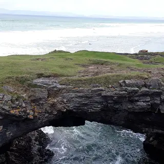 Fairy Bridges and Wishing ChairCliffs · BundoranSea arches and a rock seat cut into the low cliffs on the west side of Bundoran, reached on foot off the Rougey walk.
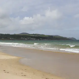 Culdaff BeachBeach · CuldaffSand and rock coves on the northeast coast of Inishowen, lifeguarded through the summer.
19 more from Fáilte Ireland’s listings
- Tullan StrandBeach · BundoranPopular with serious surfers, Tullan Strand is a 2km beach stretching from the north end of Bundoran Town to the Erne Estuary at Ballyshannon.
- Port Arthur BeachBeach · Derrybeg
- Lisfannon BeachBeach · FahanCatch a sunset or go for a ramble along Lisfannon Beach, a long sandy strip on the southwest edge of the Inishowen Peninsula.
- Inis Bó Finne (Inishbofin Island)Island or harbour · InishbofinThe sandy beaches, dramatic cliffs and hidden caves of Inis Bó Finne (Inishbofin Island), 3km off the coast of Donegal, is a haven for a myriad of bird life and a popular spot for water sports.
- Ballymacool Town ParkPark · Letterkenny
- Bernard McGlinchey Town ParkPark · LetterkennyBernard McGlinchey Town Park, also known as Letterkenny Town Park, is a public park located in Letterkenny, County Donegal.
- Málainn Bhig (Malinbeg)Beach · Malin Beg
- Bá Bhaile Uí Thiarnáin (Ballyhiernan Bay)Beach · Co. DonegalSet along a rural stretch of northeast Donegal near the village of Rosnakill, Bá Bhaile Uí Thiarnáin (Ballyhiernan Bay) is a long, sandy beach perfect for walking and exploring.
- Bundoran BeachBeach · Co. DonegalBundoran Beach is located in County Donegal, just 250 metres off Bundoran town's Main Street.
- Cionn Mhucrois (Muckros Head)Headland or viewpoint · Co. DonegalHead for a bracing cliff walk, go rock climbing or stop to take in the view of the wild Atlantic from the rugged peninsula of Muckros Head.
- Fintra BeachBeach · Co. DonegalTake a walk along the long, sheltered beach, which stretches approximately 1km along the bay.
- Five Fingers StrandBeach · Co. DonegalFive Fingers Strand is located along Trawbrega Bay, just off the main road between Malin Town and Malin Head, on the Inishowen Peninsula in County Donegal.
- Gabhla (Gola Island)Island or harbour · Co. DonegalLess than 2km from the Donegal mainland, the 326 hectare Gabhla Island (Gola Island) is a haven for artists, birdwatchers, photographers, walkers and rock climbers.
- Killahoey BeachBeach · Co. DonegalKillahoey Beach (Tra na Cille), also known as Dunfanaghy Beach, is located close to the town of Dunfanaghy (Dun Fionnachaidh) on the northern coast of County Donegal.
- Kinnagoe BayBeach · Co. Donegal
- Murvagh BeachBeach · Co. DonegalBacked by extensive dunes and forest, Murvagh Beach makes for a great day of exploration.
- PortsalonBeach · Co. DonegalPortsalon Beach, on the Fanad Peninsula in County Donegal, is a very extensive sandy beach shelving gently towards the Atlantic Ocean.
- Ros Goill (Rossguill Peninsula)Beach · Co. DonegalSet between the headlands of Melmore Head and Horn Head, this point on the Rosguill Peninsula in northeast Donegal offers dramatic open views over the Atlantic coastline.
- StrooveBeach · Co. DonegalStroove Beach is located close to the village of Greencastle.
Down10 places
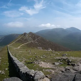 Mourne MountainsMountain · NewcastleA granite range in the south of the county. The dry stone Mourne Wall, built between 1904 and 1922 to mark off the water catchment, runs over its summits.
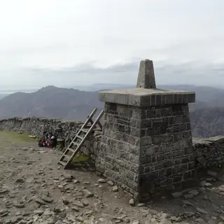 Slieve DonardMountain · NewcastleThe highest mountain in Northern Ireland stands over Newcastle, and the Great Cairn on its summit holds the highest passage tomb in Ireland.
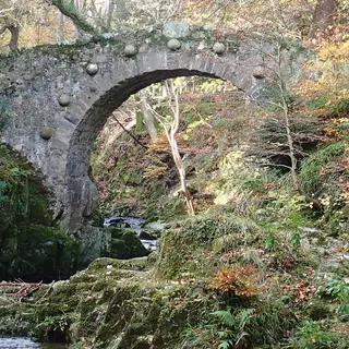 Tollymore Forest ParkForest · NewcastleForest at the foot of the Mournes near Newcastle, open all year, with views of the sea and paths on foot up to Slieve Donard and Slieve Commedagh.
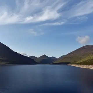 Silent Valley ReservoirLake · KilkeelBelfast's water supply reservoir in the high Mournes was begun in 1923 and opened in 1933, and a trail runs up the valley to Ben Crom Reservoir.
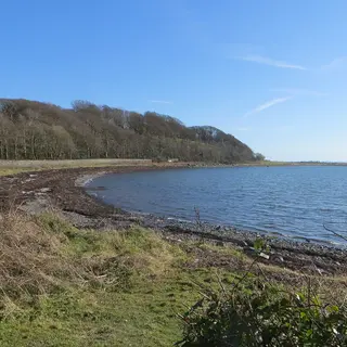 Strangford LoughLake · StrangfordThe largest sea lough in the British Isles and a Marine Conservation Zone, crossed at its narrow mouth by the Strangford to Portaferry ferry.
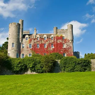 Castlewellan Forest ParkForest · CastlewellanForest park on the north side of the Mournes with a lake you can fish and canoe on, and the Annesley Garden and Arboretum inside the grounds.
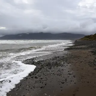 Murlough National Nature ReserveNature reserve · NewcastleSand dunes up to six thousand years old on the shore between Dundrum and Newcastle, and Ireland's first national nature reserve.
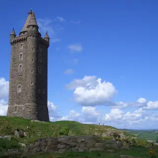 Scrabo TowerViewpoint · NewtownardsA stone tower finished in 1859 on top of Scrabo Hill above Newtownards, in a country park of woodland and old quarries looking over Strangford Lough.
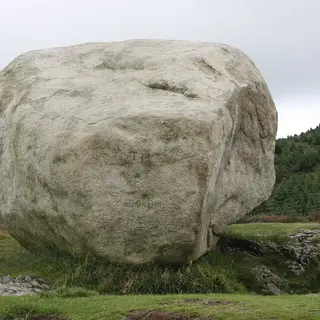 Cloughmore StoneViewpoint · RostrevorA granite boulder of about forty tonnes, left on the slope of Rostrevor Forest at the end of the last ice age, with views across Carlingford Lough.
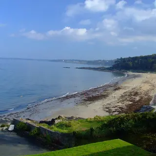 Crawfordsburn Country ParkPark · BangorCountry park on the Belfast Lough shore between Bangor and Holywood, with two beaches and woodland walks that take in a waterfall.
Fermanagh5 places
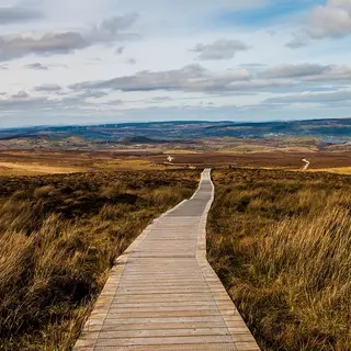 Cuilcagh Boardwalk TrailWalk · FlorencecourtA gravel track and then a wooden boardwalk across blanket bog, finishing with a steep flight of steps up to a viewing platform on the edge of the Cuilcagh plateau.
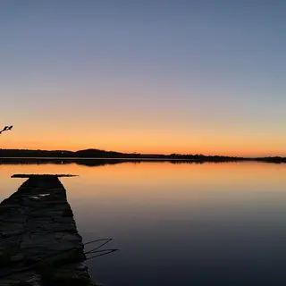 Lough ErneLake · EnniskillenThe Erne widens into two loughs, the upper one south of Enniskillen and the lower one north of it, both scattered with wooded islands.
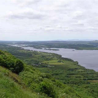 Lough Navar Forest and the Magho viewpointViewpoint · DerrygonnellyA forest drive climbs through the trees to the Magho viewpoint on top of the cliffs, looking down on Lower Lough Erne and its islands.
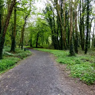 Castle Archdale Country ParkPark · IrvinestownWoodland on the shore of Lower Lough Erne, with walks along the water and waymarked trails running on into the forest beside the ruins of Castle Archdale.
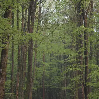 Castle Caldwell ForestForest · BelleekMixed woodland on two promontories on the Lough Erne shore near Belleek, with waymarked trails and the fenced-off shell of Castle Caldwell among the trees.
Monaghan8 places
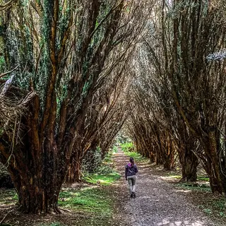 Rossmore Forest ParkForest · MonaghanRossmore's old estate outside the town has colour coded trails, a lake and a family cycle route through it.
 Lough Muckno Leisure ParkPark · CastleblayneyThe Blayney and Hope families, the landlords of Castleblayney, once held this estate on the shore of Lough Muckno. It is public parkland now, with forest and lakeside trails.
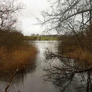 Dartrey ForestForest · RockcorryDawson's old estate between Cootehill and Rockcorry has lakes linked by the Dromore river and a famine wall along the road.
- Emy LoughLake · EmyvaleEmy Lough sits just outside Emyvale, with a four kilometre looped walk around it.
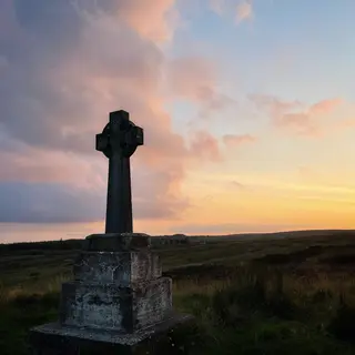 Sliabh Beagh WayWalk · ScotstownThe route runs over the bog and heather of Sliabh Beagh, along the northern county boundary.
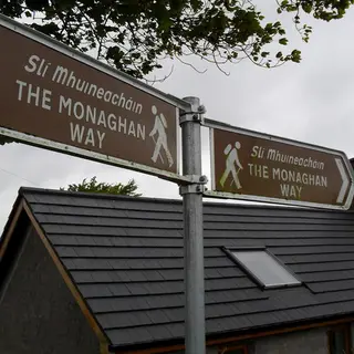 The Monaghan WayWalk · MonaghanThe route crosses the middle of the county, signposted the whole way with fingerposts.
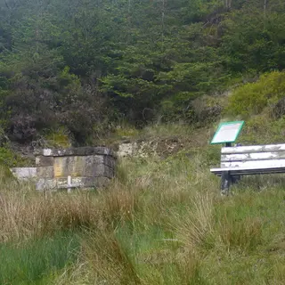 Knockatallon Looped WalksWalk · ScotstownLooped walks on the Sliabh Beagh slopes at Knockatallon, passing the penal era mass rock at Poll an Altair.
1 more from Fáilte Ireland’s listings
Tyrone5 places
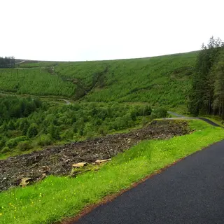 Gortin Glen Forest ParkForest · GortinThe first forest park in Northern Ireland to be opened in a conifer plantation, on the B48 between Omagh and Gortin, with a scenic drive and waymarked trails.
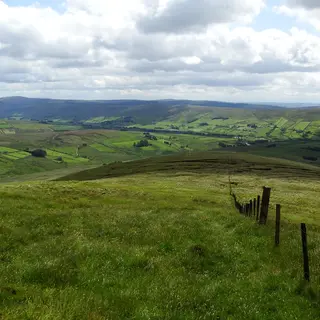 Glenelly ValleyValley · PlumbridgeThe Glenelly River runs west along this valley in the Sperrins down to Plumbridge, with Sawel, the highest of the range, on the ridge to the north.
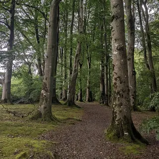 Drum Manor Forest ParkForest · CookstownThe Forest Service took over the old Drum Manor estate near Cookstown in 1964, and its waymarked trails go round the forest and a wildfowl lake.
2 more from Fáilte Ireland’s listings
Dogs and the rules
Can I bring a dog to an Irish beach?
On most beaches, yes, on a lead, and off it where the signs allow. The exceptions are the bathing beaches in summer: Fingal, for one, bans dogs from the Blue Flag area of Portmarnock, Donabate and Rush between 11am and 7pm from the 1st of June to the 15th of September, and most Blue Flag beaches keep dogs off the flagged bathing area in season. The sign at the car park is the rule for that beach.
Are dogs allowed in Ireland's national parks?
Yes, on a lead, in all six: Killarney, Glenveagh, Connemara, the Burren, Wicklow Mountains and Wild Nephin. The lead is for the sheep and the deer as much as for the dog, and a farmer may lawfully shoot a dog found worrying sheep. The houses and formal gardens inside a park, Muckross House for one, usually keep dogs outside.
What about forest parks and Coillte woods?
Coillte's forests and forest parks allow dogs; the rule on most of them is a lead, and the signs at the entrance say where it is relaxed. Lough Key, Avondale, Gougane Barra and Ards Forest Park are all walked with dogs every day.
Which places on this site do not take dogs?
Castles, houses, museums, gardens, distilleries, wildlife parks and most islands with a ferry. Assistance dogs are the exception everywhere. Where a place is run by the OPW, its own page says whether dogs are allowed in the grounds.